Skip to content
Black History In The Bible | #BHITB

Black History In The Bible | #BHITB

A Virtual Museum of Israelite History & Culture

  • About
  • The Omnidex
  • Community
  • Courses
  • Projects
    • Digital Time Capsule Project
  • Submit An Item
  • Donate
    • Sponsor An Exhibit
    • Donor Wall
  • Gift Shop
  • Toggle search form
1720 Map of The Kingdom of Judah In Africa

1720 AD: Map of The Kingdom of Judah In Africa

Posted on August 8, 2018October 29, 2023 By Dante Fortson No Comments on 1720 AD: Map of The Kingdom of Judah In Africa
Print Friendly, PDF & Email
Bookmark (1)
Please login to bookmark Close

judah-in-africa/" />

  • About This Exhibit
  • More Info
  • Sponsor This Exhibit
This map shows The Kingdom of Judah located in West Africa in 1720.
Link: Sanderus Creator: G. De L'Isle Date: 1720 AD Title: Map of West Africa, Oriented to the North
BHITB and our affiliate sites are made possible by our sponsors. If you are interested in sponsoring an exhibit, please see our sponsor page for full details and benefits of becoming a sponsor. Click here to view our Sponsor Page.
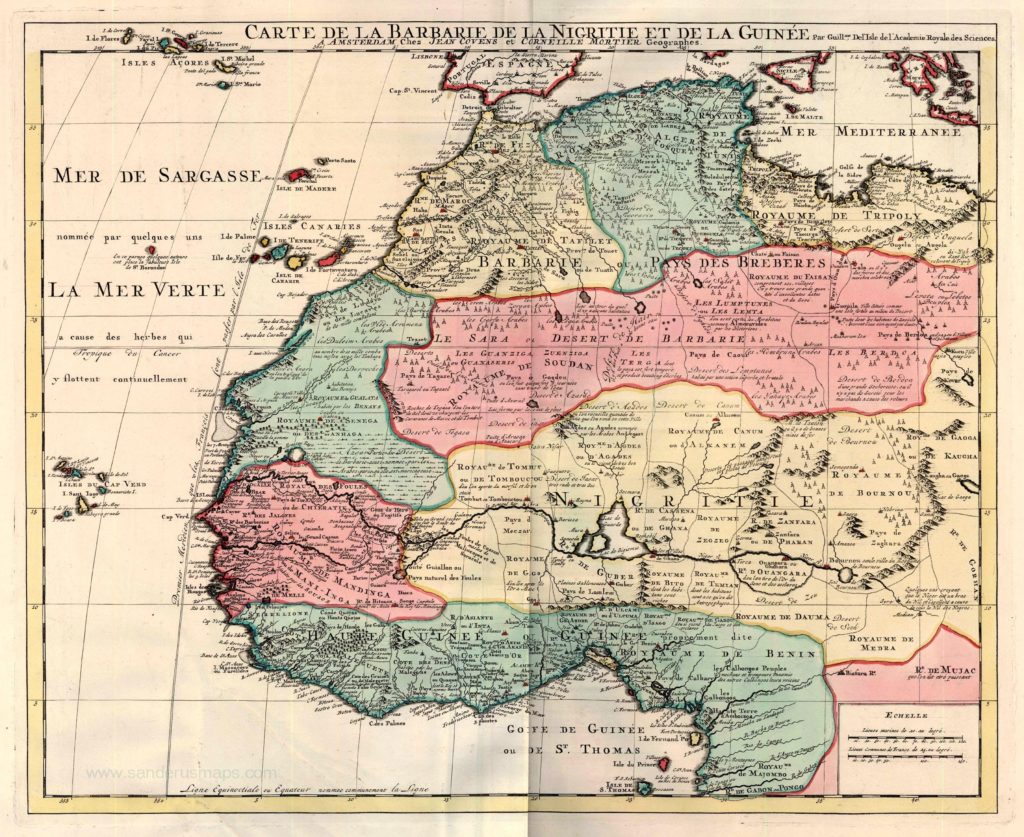
1720 Map of The Kingdom of Judah In Africa
Composite Atlas. Amsterdam, Covens & Mortier, c. 1720.
*The Omnidex*, Forgotten Migrations Tags:1700s AD, 1720 AD, Africa, Amsterdam, G De LIsle, Netherlands, The Kingdom of Whydah / Juda, West Africa

Post navigation

Previous Post: 1967 AD: The Zondervan Controversy: Negroes Are Not From The Line of Ham
Next Post: 1743 AD: Homann Heirs Map of Juda On The West Coast of Africa

Leave a Reply Cancel reply

You must be logged in to post a comment.

Choose Your Language

My BookmarksShare

  • No bookmark found

Affiliate Sites

  • BHITB University
  • Hebrewsphere
  • JIHAAD.org

Resources

  • African Israelite Justice Foundation
  • Black Demographics
  • Slave Voyages
  • Internet Jewish History Sourcebook

Copyright © 2025 Black History In The Bible | #BHITB.

Powered by PressBook WordPress theme